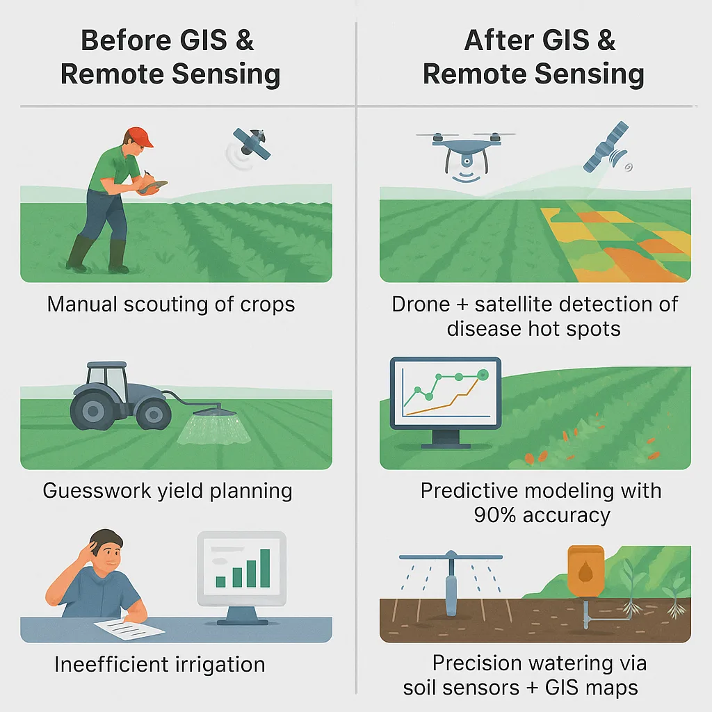
Let’s face it—farming in 2025 isn’t just about tractors and tillers anymore. It’s about satellites, sensors, and software. With climate change bringing chaos and food demand soaring, agri-businesses can’t afford to operate on guesswork.
That’s where GIS and remote sensing in agriculture come in. These aren’t futuristic toys—they’re game-changing tools that help farmers monitor crops from space, detect diseases before symptoms show, and squeeze more yield from every acre.
Whether you manage 50 acres or 50,000, these technologies offer smarter ways to grow, irrigate, and plan. In this blog, we’ll dive deep into five high-impact use cases that combine sustainability with ROI—making your agri-tech investment truly future-proof.
Precision Crop Monitoring: The Farmer’s Eye in the Sky

Gone are the days of walking rows to check crop health. Today, satellites and drones do the legwork—and they’re way more precise.
How it works: Using multispectral imagery, NDVI (Normalized Difference Vegetation Index), and even thermal cameras, you can detect early signs of crop stress—like water shortages or pest pressure—before they’re visible to the human eye.
Real-world win: In India, sugarcane farmers using NDVI plant health maps pinpointed drought-stressed fields early. A quick fix with targeted irrigation saved their yields and reduced water use by up to 40%.
Bottom line: Satellite imagery is like having a remote sensing crop monitoring system that never sleeps. With weekly or even daily updates, farmers can proactively manage problems before they escalate—saving money, labor, and time.
Disease and Stress Detection with AI-Enhanced Imagery
What if your crops could tell you they were sick—before they started wilting?
With AI + drone imagery, that’s exactly what’s happening.
Tech in action: Convolutional Neural Networks (CNNs) scan aerial images for subtle changes—like leaf discoloration or canopy thinning—that signal disease or nutrient deficiencies.
Case study: California vineyards now use thermal sensors to detect water stress in grapevines days before leaves show signs. That means fewer losses and more consistent quality.
Why it matters: These AI-enhanced tools reduce dependency on manual scouting, which can miss early symptoms. When diseases like blight or mildew spread fast, early intervention can save entire fields.
This is one of the many precision agriculture technologies transforming farming operations.
Yield Prediction with Remote Sensing + Machine Learning
Forecasting your harvest used to mean crossing your fingers. Not anymore.
Today’s yield predictions combine satellite data, agricultural data mapping, soil maps, planting records, and AI to forecast harvests with 90%+ accuracy.
How it works: AI in crop yield prediction systems use ML models like LSTMs to anticipate outcomes based on historical and real-time remote sensing inputs.
Impact: In Kenya, maize farmers used AI models to anticipate drought-induced yield drops. That info helped coordinate food aid and prevented shortages before they began.
Added bonus: Yield prediction supports smarter logistics and supply chain planning. Distributors can arrange transport, storage, and retail delivery with higher precision, minimizing waste.
Variable-Rate Input Application (VRT)
You wouldn’t water your entire lawn if only a few patches were dry. Same goes for your fields.
VRT (Variable Rate Technology) uses GIS mapping for farmers to apply exactly the right amount of fertilizer, pesticide, or water—only where needed.
Use case: In Australian cotton fields, VRT reduced nitrogen runoff by 22%, protecting both yields and ecosystems.
Next-level benefits: When paired with AI, VRT systems can adjust in real time based on updated crop models or even weather forecasts, boosting both ecological and economic returns.
Together with smart farming tools, this approach optimizes input use while reducing environmental impact.
Land and Water Management with LiDAR and Soil Mapping
Water is liquid gold in agriculture. Using LiDAR and soil data, farmers can now sculpt their fields for optimal irrigation and erosion control.
How it helps: LiDAR maps every slope and depression, helping you redesign irrigation systems for minimal waste.
Example: MIT’s solar-powered smart irrigation in Kenya combines terrain data and soil sensor IoT tech to cut water use by 30% in arid regions.
Strategic insight: GIS and remote sensing in agriculture aren’t just about where things are—it’s about how to make them work smarter together. From leveling fields to siting new infrastructure, topography data is critical.
These practices are key pillars of satellite farming solutions, which combine spatial intelligence with automation for maximum output.
Benchmarking ROI from GIS & Remote Sensing
Here’s a quick snapshot of how these tools stack up in terms of ROI:
| Use Case | ROI Timeline | Avg. Cost Savings | Yield / Input Impact |
| NDVI Monitoring | 1 season | $10–$30/acre | ↑ Yield, ↓ Water Use |
| Disease Detection | 1–2 seasons | Varies by crop | Prevents total crop loss |
| VRT Fertilization | 1 season | 15–25% less input use | ↓ Nitrogen, ↑ Efficiency |
| LiDAR Mapping | 2–3 seasons | Infrastructure savings | ↓ Erosion, ↑ Irrigation Precision |
Getting Started: How to Implement GIS & Remote Sensing Tools
You don’t need a NASA budget to get started.
- Start simple: Use free satellite imagery (e.g., Sentinel) via platforms like Farmonaut.
- Use QGIS or ArcGIS: These tools help visualize and analyze field data—even for non-techies.
- Pilot first: Apply these tools to one crop or field, and scale as ROI becomes visible.
- Consider partners: Platforms like Cropin or EOSDA bundle satellite insights with mobile dashboards.
Pro tip: Even modest investments—like drone surveys twice per season—can yield high returns, especially for high-value crops. It’s how small and medium farms are stepping into agriculture 5.0.
GIS and Remote Sensing in Agriculture Challenges to Watch Out For
Let’s be real—every tool has a learning curve. Here’s what to look out for:
- Connectivity gaps: Some farms don’t have the internet speeds needed for real-time sync.
- Skill shortages: GIS and image analysis aren’t part of traditional farm training—yet.
- High upfront costs: Drones and sensors can be pricey, though “drone-as-a-service” models help.
- Data integration: Legacy systems don’t always play nice with new tech.
Solutions are coming: Agri-tech providers are rolling out low-cost tools, training modules, and offline-first apps to help overcome these issues.
Explore Smarter Farming with Beam Data
GIS and remote sensing in agriculture aren’t just buzzwords—they’re the backbone of agriculture 5.0. They help farmers grow more with less, act faster, and waste less.
Whether you’re growing coffee in Kenya or corn in Kansas, these tools can help you manage climate risk, boost profits, and farm with confidence. From agricultural data mapping to AI in crop yield prediction, the future of farming is here. It’s not just about maps—it’s about mastery.
If you’re ready to take the next step into data-driven agriculture, Beam Data offers an integrated platform designed to simplify GIS and remote sensing in agriculture. From agricultural data mapping to remote sensing crop monitoring, BeamData equips farmers with actionable insights through satellite imagery, AI models, and smart farming tools.
Whether you’re experimenting with soil sensor IoT or scaling up precision agriculture technologies, Beam Data helps unlock higher yields, better resource management, and real ROI—bringing the promise of agriculture 5.0 to your farm today.
FAQs
- What’s the difference between GIS and remote sensing?
GIS organizes and analyzes spatial data. Remote sensing collects that data via drones or satellites. - Can small farms afford GIS and remote sensing?
Yes. Free tools (like QGIS and Sentinel imagery) and low-cost drone services make them accessible. - Are drones better than satellites?
Drones offer higher resolution and on-demand data, but satellites provide broader, more frequent coverage. - How soon can I see ROI from remote sensing?
In most cases, within 1–2 seasons, especially for high-value crops or water-intensive regions. - What’s the first step to getting started?
Start with free NDVI plant health imagery platforms, then test smart farming tools like drones or soil sensor IoT devices for targeted decision-making.